
If you have an interest in the people, places, science, literature or history of the Humber, then you can take our virtual tour of the Humber below.
As part of our Olympic Challenge this year (to run, walk, swim or cycle 40 miles, the length of the Humber), we worked with colleagues across the University to have a series of articles that would take us on a virtual Humber walk. Sharing their knowledge, experience, passion and insights, our academics have written a fascinating series of articles that will open up the Humber to you and show you the estuary in a whole new light.
The #HumberWalk21 project was co-ordinated by Professor Briony McDonagh, Director of the Doctoral College & Professor of Environmental Humanities, Energy & Environment Institute at the University of Hull. She said:
“Our walk is imaginatively set along the Humber Estuary, a familiar sight both to our alumni and to the local communities we work with as part of the Risky Cities project (find out more about this project below). 40 miles represents the distance between the confluence of the rivers Ouse and Trent (and the start of the Humber Estuary) and Spurn Point, where the estuary waters meet the North Sea. It’s a journey I’ve undertaken over the last 18 months, walking short sections of the north bank of the Humber when possible under national lockdowns – and when not on crutches as a result of Joe Wicks lockdown PE (true story!).
“In bringing you a series of blog posts to accompany your own 40-mile walk, I’ll be sharing some of my own reflections on my research as a scholar of the environmental humanities working alongside colleagues from across the physical and environmental sciences, social sciences, humanities and arts. Many of those colleagues have also kindly agreed to share their own thoughts and reflections on their research sites and projects located along the Humber shoreline.”
Part one: Living with water in a changing climate
Professor Briony McDonagh, Director of the Doctoral College & Professor of Environmental Humanities, Energy & Environment Institute at the University of Hull
In this blog series, I’ve returned to an idea first explored in a public talk I did a few years ago – of walking the Humber shore accompanied by a variety of experts. In 2018, I was very pleased to be asked to serve as a Geography Section President for the British Science Association. At the British Science Festival held in Hull that September, I delivered my Presidential Address titled At the Edge of the Humber. I spoke about how the Humber is – and always was – a hugely dynamic environment and explored the ways that people living and working along its margins have constantly negotiated changing relations between the land and water – a task today made all the more pressing in the face of an uncertain future climate.
Part two: Helping to inform flood risk management in the Humber estuary
Dr Rob Thomas and the IMMERSE Project Team, Energy and Environment Institute, University of Hull
The Humber drains one fifth of England (24,472 km2), and provides the largest single input of freshwater to the North Sea from the English coastline. The Humber and its surrounds house 500,000 people, 120,000 ha of agricultural land, the second largest chemical cluster in the UK, two of the country’s six oil refineries, and five power stations. More than 25% of the UK’s primary energy supply flows through the region, and its ports handle 14% of UK trade.
Part three: Making connections along the Humber
Dr Kate Smith, Researcher, Flood Innovation Centre, University of Hull
Whether seen at eye-level from the train through Brough, or close at hand along the Trans-Pennine trail, the Humber between Brough and North Ferriby is a pretty tranquil place of shimmering mudflats, grazing sheep and quietly rippling tides. The occasional freight vessel gives little indication that the deep waters of the estuary are still one of the busiest shipping areas in the UK.
Part four: Living with water in a changing climate – responding to floods in west Hull
Dr Sam Ramsden, Energy and Environment Institute, University of Hull
Thanks for joining me after your walk so far. As you may know Hull is vulnerable to flooding from a range of sources. The devastating floods of 2007 were caused by heavy rains which overwhelmed the city’s drainage system. Over 20,000 people were affected, 8,800 households were flooded, and over 5,000 households had to evacuate. You can read a report investigating the floods by Professor Tom Coulthard here. In 2013, areas of Hull along the Humber were flooded by a tidal surge. There have also been more localised flooding incidents including in 2014 and the winter of 2019/20 and the risk of flooding is increasing due to the impacts of climate change.
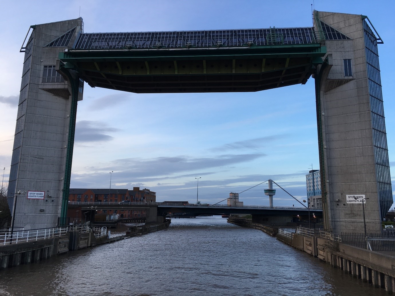
Part five: River Hull Tidal Surge Barrier
Dr Stuart McLelland, Deputy Director, Energy and Environment Institute at the University of Hull
As you approach the west end of Humber Street (the new, fashionable place to live in Hull City Centre) near the Marina in the centre of Hull, you will catch glimpses of the Hull Tidal Surge Barrier. If you didn’t see it and it wasn’t there, those of us living and working in Hull would regularly get very wet, or worse…
Before the River Hull Tidal Surge Barrier was constructed, Hull City Centre often experienced flooding from very high Spring tides and tidal surge events. This is an inevitable consequence of building a city on land that is either part of a floodplain or reclaimed from the sea.
Part six: Engaging Communities with the Challenges of Climate Change
Katie Parsons, Department of Geography, University of Hull
Immediately after the tidal barrier along the Humber’s north bank you arrive at Sammy’s Point. This land on the seaward junction of the river Hull and the Humber estuary was once a large shipyard run by Martin Samuelson. Hundreds of steam vessels were made here in the 1800s, but it is now home to the iconic and internationally recognised landmark that is, The Deep.
Part seven: Helping to understand sediment, nutrient and chlorophyll dynamics in the Humber estuary
Dr Greg Vasilopoulos and the IMMERSE Project Team, Energy and Environment Institute, University of Hull
Like many other estuaries, the Humber is very rich in sediment and nutrients. Previous work has shown that the sediments found in the Humber have their source in the North Sea and the eroding cliffs of the Holderness coast, while the Ouse and Trent rivers that flow into the estuary contribute only modestly. On the other hand, the Ouse and Trent contribute a considerable amount of nutrients (Nitrogen and Phosphorus) into the Humber. This is important because excess nutrients in estuaries can increase primary production driving eutrophication, algae blooms and hypoxia that can harm sensitive ecosystems.
Part eight: A Literary History of Sunk Island
Dr Stewart Mottram, Senior Lecturer in English, University Hull; Co-Investigator on the AHRC project, Risky Cities: Living with Water in an Uncertain Future Climate; and deputy director of the Leverhulme Doctoral Scholarships Centre for Water Cultures
The broad sweep of the Humber Estuary, the subject of our #HumberWalk21 series of blogs, is reimagined in Philip Larkin’s poem, ‘Here’ (1964), which describes ‘swerving to solitude’ east beyond Hull to the ‘Isolate villages’ and ‘neglected waters’ of Holderness. ‘The widening river’s slow presence’ shapes the lines and landscape of Larkin’s poem, and Larkin is only one of several writers who have found inspiration along the Humber’s shores.
Part nine: Mud, mud and defences
Dr Sue Hull, Senior Lecturer in Marine Biology and Ecology / Programme Director for Marine Biology, University of Hull
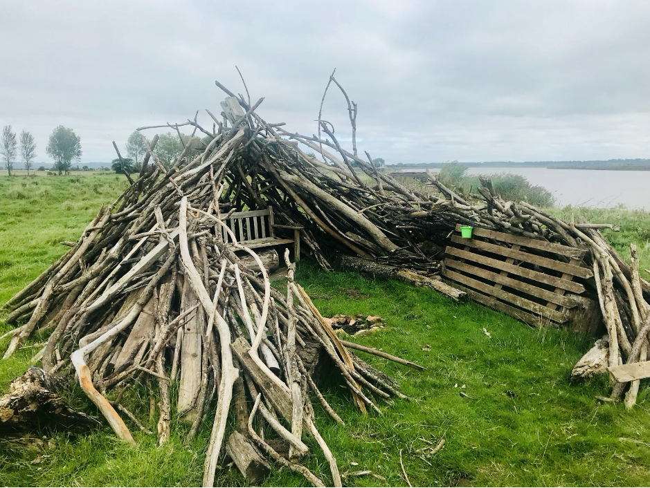
It feels like you are walking towards the end of the world heading south from Easington. Here, down at the estuary end of Humber Side Lane there is a curious mixture of the natural and the human-made, the future and the past all intermingled in the area between land and sea. These muds and silts of the Humber with the water glistening in the sun at least 500m away at low tide provide habitat for a wealth in of intertidal invertebrates. From worms to clams, they occur as patches of free food for thousands of over-wintering wading birds and the salt marsh itself provides them cover from the brisk winds at high tide. Here in the intertidal, one of the harshest marine environments there is, marine species are exposed to terrestrial and fully marine conditions at the whim of the tide. Here we become aware of a bleak, uniform, and unforgiving landscape.
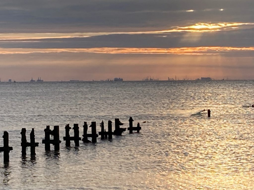
Part ten: Spurn Point – the nation’s newest island
Dr Magnus Johnson, Senior Lecturer in Environmental Marine Science, University of Hull
What we see on Spurn Point now is a remnant of a once thriving community, including a railway line that ran from the town of Kilnsea at the top of the point, three pubs, ABP offices and lookout point, one of the only residential lifeboat stations in the UK, a University of Hull field station and two lighthouses. It is not alone in its deterioration, more than 30 settlements along the Holderness coast have been lost due to coastal erosion since the 19th Century. Now the Ocellarum Promentorium, as the Romans apparently called it, has been all but separated from the mainland by the 2013 storm that washed away the road and left a 150m gap.
Part eleven: an end (and a beginning)
Professor Briony McDonagh, Director of the Doctoral College & Professor of Environmental Humanities, Energy & Environment Institute at the University of Hull
Over this eleven-blog series linked to the University of Hull Alumni Olympic Challenge (#HumberWalk21), we’ve collectively travelled more than 40 miles from Trent Falls to Spurn. In real life, it’s taken me more than a year to walk this route from Boothferry Bridge (which crosses the River Ouse just south-west of Howden and about 11 miles upstream from Trent Falls) to the tip of Spurn Point. I’ve done it in short sections, with friends or with my kids on various sunny weekends – plus at least one very long section near Broomfleet and Crabley Creek in driving rain (‘there’s no such thing as bad weather, only inappropriate clothing’, as colleagues in the Department of Geography, Geology & Environment would tell me).

Great to see this compendium and my hearty congratulations to all contributors. The Humber is the jewel in Hull’s crown. But, in contradistinction to other British estuaries e.g. The Tay, The Mersey etc., the lack of proximal high ground means that it is often forgotten by citizens of its biggest city. It can’t be seen – at least not easily and not unless on its shores. The sad segregation of the Humber from the city, when the dualled A63 sliced through it, cut it from its citizens’ consciousness. Hull, de facto and for the main part, turned away from its expansive waterway and lost connection. Those of us who go back in time will fondly recall the British Rail paddle-boat ferry connecting with New Holland in north Lincolnshire. And, of course, Hessle was, in those days, firmly attached through the nation’s biggest fishing fleet. But, even then, in those times before the Bridge, comparatively few ventured to view the wonders of The Humber. Later, the development of Victoria Dock provided some lucky residents with a view. And, more recently, the opening of the new footbridge across the roaring A63 will facilitate more visitors. This means that more of Hull’s citizenry will have less excuse for not gazing over the city’s best natural feature.
LikeLiked by 1 person
Thank you for your observations Ian, I hadn’t really considered Hull’s topographical divide from the Humber. It’s certainly true that you don’t really get a sense of just how dominant the river it is to the region until you leave Hull to the north or west and gaze down on the city and the river from the Wolds. Living in Hull, it’s easy to forget (or not to be aware in the first place) that about 20% of England’s surface water is silently rolling past you! Ben
LikeLike